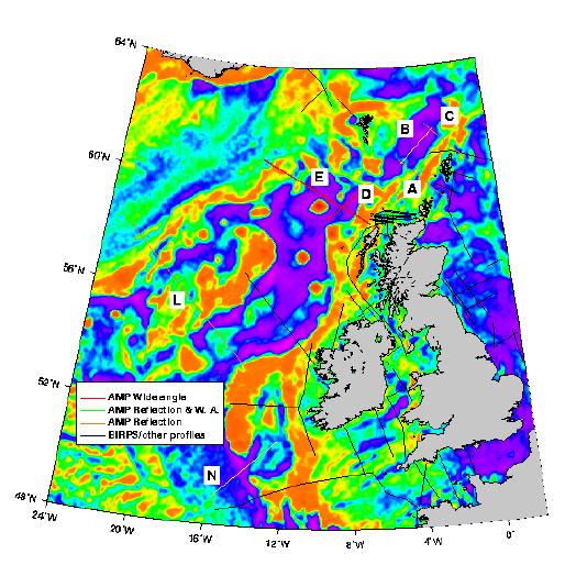
Research area of the AMP project.
Background colour is the free-air gravity map (Sandwell & Smith) with
bathymetry lines superimposed at every 500m.
Thin lines show postion of existing 2-D deep reflection profiles acquired
by BIRPS and other projects.
Solid thick lines represent data acquired by AMP, and dashed thick
lines represent other possible profiles.
Back to AMP home page